Followers

Sunday, March 24, 2019

2019 03 15 Meteor Crater Natural Landmark, 2019 03 16 Navajo Code Talkers New Mexico Veterans Memorial

Meteor Crater Natural Landmark, Flagstaff, Arizona - 15 March 2019

Walking on the path around the crater rim on the guided tour we can see the San Francisco mountains across the way still with snow caps. 


Created approximately 50,000 years ago, the meteorite impact crater was the final destination of what is suspected to be the meteor's 500 million year race through space. At about 26,000 miles per hour, in a blinding flash, it struck the rocky plain of today's Arizona with an explosive force greater than 20 million tons of TNT. The impact and ensuing displacement of rock and soil produced the crater floor large enough to hold 20 football fields. Over 175 million tons of limestone and sandstone were thrown out to form a blanket of debris surrounding the crater for a distance of over a mile and leaving a crater 700 feet deep and over 4000 feet across. 
The crater and surrounding property is still owned by the Barringer family. Tourists were allowed to view the crater and cattle that grazed on the surrounding lands.


 During mining operations this small cabin was occupied by the miners during severe storms. It was also the storage space for the dynamite used during mining operations. Some clever person during a lightning storm finally thought it would be a better idea to store the dynamite elsewhere. The Widow Barringer is said to have spent much of her time at this cabin which had running water. She had ranch cowboys haul her old manual washing machine up to it so she could get her chores done while answering questions.    


We are not standing at the edge of the crater because the soil underneath is still too damp from snowfall and rain. The rock outcrops are loose and might dump anyone venturing out to the edge down into the crater. To the right of Bob a shiny object can be seen on the crater floor. That is a piece of a private plane which crashed on a site seeing flight in 1964. The 2 on board survived but the plane was left there to hopefully deter anyone else from flying into the crater. Good ideas sometimes backfire and more planes began to fly over. Finally it was decided to remove the plane debris and dump all but that one piece into the now abandoned mine shaft. 


This is the storage area for the mining. There is a story of a young family visiting the crater who attempted to investigate this "cave". When they got close to the entrance a mountain lion ran out so now the entrance is covered with chicken wire. And the dynamite was removed. Just for safety.


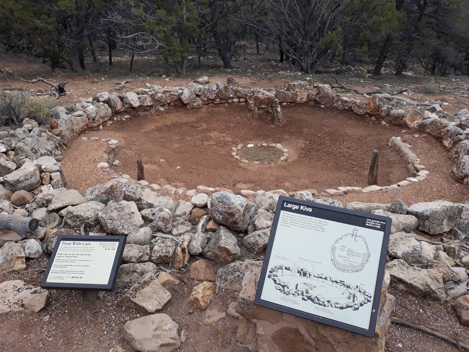
The inner circle is where the mining operations took place. On the right is the Visitor's Center, Gift Shop and Theater. Fun facts - in 1984 the movie Starman was filmed here. It tells the story of a humanoid alien (Jeff Bridges) who has come to Earth in response to the invitation found on the gold phonograph record installed on the Voyager 2 space probe. Second Fun Fact - Astronauts trained here, conducting mapping and surveying drills in and around the crater for moon landings. Today, astronauts are tutored for planetary surface operations, which require different talents than those needed for past space shuttle flights and work on the International Space Station.

The Holsinger Meteorite is the largest discovered fragment of the 150-foot meteor that created Meteor Crater.  Most of the meteorite fragmented and disintegrated.  

Did we really get down to the bottom of the crater?
Window Rock Tribal Park & Veteran's Memorial, Window Rock, Arizona - 16 March 2019

An amazing natural space for a memorial to the Navajo Code Talkers of World War II. Bilingual Navajo speakers specially recruited during the war by the Marine Corps to serve in communication units of the Pacific theater. The Japanese were adept at breaking standard military codes until the Code Talkers began being utilized. Originally 29 members but as the war progressed more than 400 Navajos were recruited as Code Talkers.

This natural "window" is a wind-eroded opening in the sandstone cliffs that overlook the administrative buildings of the town of Window Rock which is the capital of the extensive Navajo Nation Reservation, Apache county. It was established in 1936 as the Central Agency Headquarters to consolidate the many agencies scattered throughout the reservation  

The park features a line of sandstone cliffs that reach up to 200 feet. This sculpture represents 16 steel bayonets for the 16 tribes who provided Code Talkers. The circular path is transected by color coded paths marking the four major compass points - white (East), blue (South), red (West) and black (North). 

A list of the Navajo Code Talkers.

The gnarly old pine is growing directly out of a huge rock.

A path behind the window's cliff revealed more lines of cliffs. 

Like giant arms of sandstone wrapping around.

Left over snow that is hanging on in the shadows.

A local artist, Mark Begay, Sr., who was born, raised and still lives in Canyon-de-Chelly paints Navajo pictographs on natural rocks which he harvests from his family's farm at the bottom of the Canyon. His family has lived in the Canyon for over seven generations growing corn (maize), beans, squash, firing pottery and hunting game. He helped us understand the designs and sculptures of the park. We purchased the piece he is holding.

Administrative Building for the Navajo Nation.
Badlands Grill, Gallup, Arizona - 16 March 2019

A day late due to traveling, we celebrated our 39th wedding anniversary at this local restaurant. Shrimp and steak dinners saving room for a shared dessert. Please, no more Blake Shelton! (Chew tobacco, chew tobacco, chew tobacco, spit)


Sunday, March 17, 2019

2019 03 09 - 03 14 Williams Arizona and the Grand Canyon


Gila Bend, Arizona. Friday, 8 March 2019

As we left Gila Bend on Friday, 8 March 2019 the weather began to change from the sunny and warm 70s. The further away from Phoenix the more cloudy and windy until we needed our jackets stashed in the back seat. By the time we arrived in Williams, Arizona about 40 miles west of Flagstaff it was getting dark from the clouds and starting to snow. Good times.

Grand Canyon, Arizona. Saturday, 9 March 2019
A short walk or shuttle ride from our RV site to the Williams Grand Canyon train station. The Wild West Show starts at 9:15am on a sunny, cool (20 degrees), breezy morning. Shoot out at the...train depot? Just a little entertainment before boarding. 

We will journey 130 miles roundtrip from Williams to the South Rim along a rail line that dates back to 1901. Out the windows the terrain changes from high desert to prairie, prairie to ponderosa pine. Fun fact: if you scratch the outer bark of a ponderosa pine and it smells like vanilla. The ponderosa's change color as they get older, acquiring its reddish bark when they are around 100 years old. There are several classes of car and service. Pullman, Coach, First, Observation, Luxury Parlor and Luxury Dome. There is also a cafe car. 


Entertainment on the train. A few songs, some jokes and a couple stories as we pass through the desert portion of the ride. 


Train car and first view of Grand Canyon from the train. 
Ride an original 1923 Harriman-style coach car with seats that flip so families can face each other or a 1950s Streamliner with extra large windows. After 2.5 hours it was "Goodbye" train and "hello" canyon selfie. It was a relaxing ride and we didn't have to worry about parking. Disembarking the train, we boarded our tour bus for the drive to Maswik Lodge for lunch. To the west of the Bright Angel Lodge, it is a smaller facility off the heavily traveled Village Loop Drive. 
Our first tour stop after lunch was clear across to the east side of the rim. The Yaki Point is closed to private cars so only tour vehicles are permitted. It is considered one of the best points for sunrise and sunset canyon views. There is no way to capture the feeling of grandeur and impossible size at the Grand Canyon.
There are several areas where guardrails are necessary for everyone's safety, especially since there has been significant rain and snow which loosens the exposed, cantilevered rocks which could be are loose in the ground and could dump the unwary into the nearly a mile into the depths of the canyon. Bob has not transgressed. 

At ten miles across, it takes a good pair of binoculars to get a more up close view. And a winter coat with two layers underneath, gloves, scarf and watch cap for the driving winds. It was great to have such a bright, sunny day to aid in keeping warm. And don't forget the long underwear and double socks. 


Tour bus was very comfortable and we met a lady on-board who had left her Friday conference and driven 8 hours to Williams for a short night's sleep before boarding the train. She really wanted to see the Grand Canyon before returning home. 

Several female elk were seen along our route trying to forage on the little available before spring actually arrives and the park.


This mule deer is looking very healthy. 


There are plenty of ravens in Arizona so I was not particularly excited...but ravens don't have such long primary feathers at the wingtips. As I watched through the binoculars, I noticed the white wing patches above and below. When the bird turned and flew towards me it was obvious that the beak was very light colored, appearing to be yellow. Not like a raven. As it flew below the rim I could see the wing number tags confirming that this was a California Condor. So exciting...and a rare sighting. Originally, 260 captive bred condors were released into the Grand Canyon. Only 90 remain. Many have returned to California. Bob found this condor's number to discover that (s)he is one of a mated pair. Sadly, few of our fellow travelers cared much about this unique sight and ignored us as we discussed our thoughts. This made our trip completely worthwhile.  


The North Rim is about 10 miles away, over a thousand feet higher in elevation than we are. That's the reason there is nothing to see beyond the edge of the rim. At this time of year it is still locked in winter until May 15 when the roads reopen. 

The Hopi House, a National Historic Landmark, has American Indian arts and crafts for sale and canyon views from the upper floor windows. 
Delicious cold spring water after standing outside for an hour was refreshing. Springs and seeps are critical natural resources providing drinking water to wildlife and Park visitors in an otherwise arid environment. It also maintains the riparian areas that offer refuge for terrestrial wildlife.  

El Tovar Hotel is another National Historic Landmark, limestone and pine hotel built in 1905. Rooms and suites are individually decorated in styles ranging from modern to traditional.

The Grand Canyon Train Depot is one of the oldest log train depots in the US and began receiving passengers on 17 September 1901. Naturalist John Muir later commended the railroad for its limited environmental impact. And on the return trip to Williams we got more entertainment. 


Red Butte, located in the Kaibab National Forest is known to the Havasupai nation as Wii'i Gdwiisa, "clenched fist mountain" and is regarded as a sacred site. 

The San Francisco Peaks with a fresh layer of snow. A volcanic range just north of Flagstaff. The highest summit in the range is Humphrey's Peak. It is also the highest point in Arizona at 12,633 feet. Somewhat higher than the 1,550 feet of Campbell Hill in Ohio. 
The train is being raided by those ruffians from the morning shoot out. These bandits are notorious for robbing the train passengers.
Even with their faces covered by bandanas it was easy to recognize these harrowing villains.

We were lucky to have the sheriff on board who served up justice.
Davenport Hill Trail, Kaibab National Forest, Arizona - Sunday, 10 March 2019

After our long day away from home, the dogs needed some outdoor time. Dogtown Lake Campground was the trail-head. The logging road was a little rough. In fact, it was rutted everywhere with rills of snow melt flowing down to the lake. 

Groves of Ponderosa pines limited sun exposure on the snow. The ground was so soggy we had barely gone 50 feet before the path disappeared under water. 

The road itself was flooded. We were thankful we had the 4 wheel drive available on the truck but what a splattered mess on the tires and running boards. 

The dogs still needed a long walk so we just wandered around the town of Williams. Another section of historic Route 66 runs through the entire town. 

The nearby mountain is named after a local man, William Sherley Williams, "Old Bill Williams". Born in North Carolina and lived for 62 years mostly in the wilderness. He spent the winter of 1832-33 around Williams, which was named after "Old Bill" by locals in 1881. 


Grand Canyon, Arizona - Monday, 11 March 2019

Took the dogs for the drive back to the east side of the South Rim to explore the Desert View Watchtower. A 360-degree view of the canyon, Colorado River and surrounding landscape. Another National Historical Landmark. 

The tower was the last of the series of visitor concession structures created by Mary Elizabeth Jane Colter to look like it was built exclusively with native stone. It is 70-feet high, four story structure, completed in 1932. The tower was designed to resemble as ancient Pueblo watchtower. The base was intentionally designed to convey a partly ruinous appearance as it rises from a rubble foundation. 
Bob celebrates the 100th Birthday of the Grand Canyon.

Lets go up. The staircase up the tower rises as an open shaft with windows that let beams of light into the staircase. At each floor, the walls are decorated with murals and petroglyph-style decorations. 

The interior of the tower with its decorations. The rock art paintings are copies of now-destroyed petroglyphs at Abo, New Mexico. This is a vertical panoramic view from bottom to top. 

Some additional close-ups.

And amazing views. 


Rooftop access on the Tower looking down on the Kiva.

View from a top level tower window. 

At the top. Well, almost the top. The wooden ladder behind me is not accessible to visitors.

Despicable Bob, shrinking and grabbing the tower. 

But he put it back.

The puppies got to leave the truck and explore the rim too. They were almost as bad as the tourists trying to go beyond the railings and fences. Hopping from one rock to another or posing for pictures in precarious locations are the most dangerous activities. 

Tori was enjoying the view. But I was keeping a grip on her leash. She can be a little too nosey at times and this is not the time.

On the left is the Vishnu Basement rock and Hance Rapids, one of the most challenging whitewater rapids along the Colorado River. They are Class 7 to 8 whitewater. We passed on that adventure. The right photo is the more placid part of the river though the turns sometimes are a test during spring rains and snow melt.  

Ravens are everywhere. They soar on thermals over the Canyon but more often we watched them riding the high winds, sometimes in pairs, like they are competing with each other, twisting and turning, diving and rolling, just having fun.

Away from the South Rim we drove to the Tusayan Pueblo Ruin. This large kiva was used for ceremonial activities. Encircling about half of the interior is a bench for participants. On the opposite side is a low opening in the stone wall for ventilation of the fire pit in the center. Originally posts along the bench supported the upper structure. The walls and roof were covered with brush and mud. Access was made by ladder through a hole in the roof.

Large spaces are family rooms while smaller spaces at each end are for storage. Access was made similarly to the kiva by ladder through a hole in the roof of each room. This ruin is one of more than 4000 archaeological sites within Grand Canyon National Park. It is believed this site was constructed around A.D. 1185.

Many of the daily activities took place outdoors in the plaza, the center of community life in front of the living area rooms. The plaza faced south allowing for good winter exposure to the sun and a view of the San Francisco peaks which were considered sacred. Plaza activities included women grinding corn, others cooking and children at play. The men supplemented food with wild game and may have had some role cultivating the farm area. Dams and terraces may have served to catch and hold what little rain fell in this area.

There is always a haze covering but the varying striations are visible denoting different soil compositions and making dating the layers easier. The redder the soil the more iron. Light colors generally denote limestone.  

Resting at our last pull-out, the Grandview Point.
Grand Canyon Railway RV Park, Williams, Arizona - Wednesday, 13 March 2019

The last few minutes of daylight through the clouds.

Next morning and well, criminy! Really, Arizona? Where's the love of sunshine and warm temperatures?

Even the cute watchdogs are wanting winter to just go away. Guess we shouldn't complain too much considering what we have seen across the country.